


PRECINCT TIVERTON, Coshocton County, Ohio
About
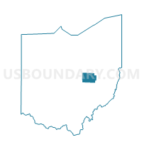
Outline

Summary
| Unique Area Identifier | 643804 |
| Name | PRECINCT TIVERTON |
| County | Coshocton County |
| State | Ohio |
| Area (square miles) | 26.19 |
| Land Area (square miles) | 26.17 |
| Water Area (square miles) | 0.02 |
| % of Land Area | 99.93 |
| % of Water Area | 0.07 |
| Latitude of the Internal Point | 40.40565610 |
| Longtitude of the Internal Point | -82.12316610 |
Maps


Graphs
Select a template below for downloading or customizing gragh for PRECINCT TIVERTON, Coshocton County, Ohio


Neighbors
Neighoring Voting District (by Name) Neighboring Voting District on the Map
- BUTLER Voting District, Knox County, OH
- PRECINCT JEFFERSON, Coshocton County, OH
- PRECINCT MONROE, Coshocton County, OH
- PRECINCT NEW CASTLE, Coshocton County, OH
- PRECINCT RICHLAND TOWNSHIP, Holmes County, OH
- UNION Voting District, Knox County, OH
Top 10 Neighboring County Subdivision (by Population) Neighboring County Subdivision on the Map
- Union township, Knox County, OH (2,646)
- Jefferson township, Coshocton County, OH (1,500)
- Richland township, Holmes County, OH (1,284)
- Butler township, Knox County, OH (1,171)
- Monroe township, Coshocton County, OH (525)
- Newcastle township, Coshocton County, OH (475)
- Tiverton township, Coshocton County, OH (449)
Top 10 Neighboring Unified School District (by Population) Neighboring Unified School District on the Map
- West Holmes Local School District, OH (18,225)
- River View Local School District, OH (15,044)
- East Knox Local School District, OH (9,490)
- Danville Local School District, OH (3,802)
Top 10 Neighboring State Legislative District Lower Chamber (by Population) Neighboring State Legislative District Lower Chamber on the Map
- State House District 90, OH (126,807)
- State House District 97, OH (124,815)
- State House District 94, OH (117,946)
Top 10 Neighboring State Legislative District Upper Chamber (by Population) Neighboring State Legislative District Upper Chamber on the Map
- State Senate District 19, OH (406,557)
- State Senate District 22, OH (370,237)
- State Senate District 20, OH (357,708)
Top 10 Neighboring 111th Congressional District (by Population) Neighboring 111th Congressional District on the Map
Top 10 Neighboring Census Tract (by Population) Neighboring Census Tract on the Map
- Census Tract 67, Knox County, OH (5,034)
- Census Tract 9766, Holmes County, OH (4,463)
- Census Tract 9611, Coshocton County, OH (4,373)